


Repair Services
In the field of surveying, instrument reliability is non-negotiable. Our expert technicians bring their meticulous skills to every repair, ensuring your equipment performs optimally. Leveraging the latest diagnostic technologies, we address a wide range of issues, delivering solutions that restore your instruments to their peak condition. Our commitment to quick turnaround times means you can get back to your projects with minimal delay.
Calibration Services
Precision is at the heart of all we do. Our calibration services are meticulously designed to enhance the accuracy of your surveying instruments. your Adhering to rigorous standards, our specialists conduct comprehensive calibrations that meet or exceed industry benchmarks. Trust us to ensure equipment delivers dependable and precise measurements, giving you confidence in your data and supporting the success of your projects.

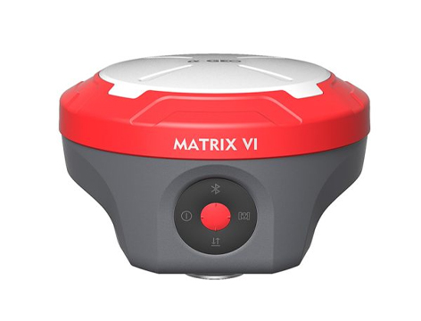
GNSS RECEIVER
LIDAR SCANNER
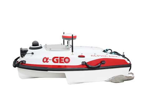
HYDRO SURVEY
RTK & SLAM HYBRID
MEASURING SYSTEM
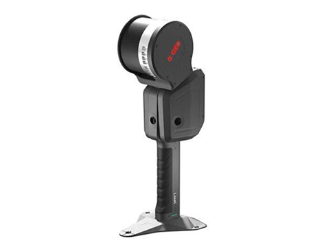
FALCON X
ALPHA GEO proudly presents the Falcon X-a groundbreaking surveying mobile terminal that integrates GNSS, high-precision vision modules, and LiDAR systems to redefine traditional RTK workflows. By combining SLAM technology with high-accuracy RTK and a powerful core processor, it delivers real-time point cloud coordinate calculations and establishes a unified coordinate system across both indoor and outdoor environments. With no need for post-processing, the data is immediately ready for engineering design, greatly improving efficiency and precision.

RTK & SLAM HYBRID
MEASURING SYSTEM
FALCON X
ALPHA GEO proudly presents the Falcon X-a groundbreaking surveying mobile terminal that integrates GNSS, high-precision vision modules, and LiDAR systems to redefine traditional RTK workflows. By combining SLAM technology with high-accuracy RTK and a powerful core processor, it delivers real-time point cloud coordinate calculations and establishes a unified coordinate system across both indoor and outdoor environments. With no need for post-processing, the data is immediately ready for engineering design, greatly improving efficiency and precision.